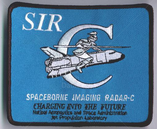
Spaceborne Imaging Radar (SIR) is a Synthetic Aperture Radar which was launched from the space shuttle Endeavour in April and October 1994. The Radar was run by Space Radar Laboratory. SIR utilizes several radar frequencies allowing for study of geology, hydrology, ecology and oceanography. Comparing radar images to data collected by teams of people on the ground as well as aircraft and ships using simultaneous measurements of vegetation, soil moisture, sea state, snow and weather conditions during each flight.
The SIR mission revealed hidden river channels in the Sahara indicating significant climate change in the past. SIR was also used for volcano research by keeping researches a safe distance from the hazardous and often inaccessible area. The radar was also used to generate detailed three demensional mappings of the Earth's surface
- Log in to post comments
2 comments
Also associated with the MAPS
Also associated with the MAPS